

Current Status and Pain Points
♦Low Operation Efficiency
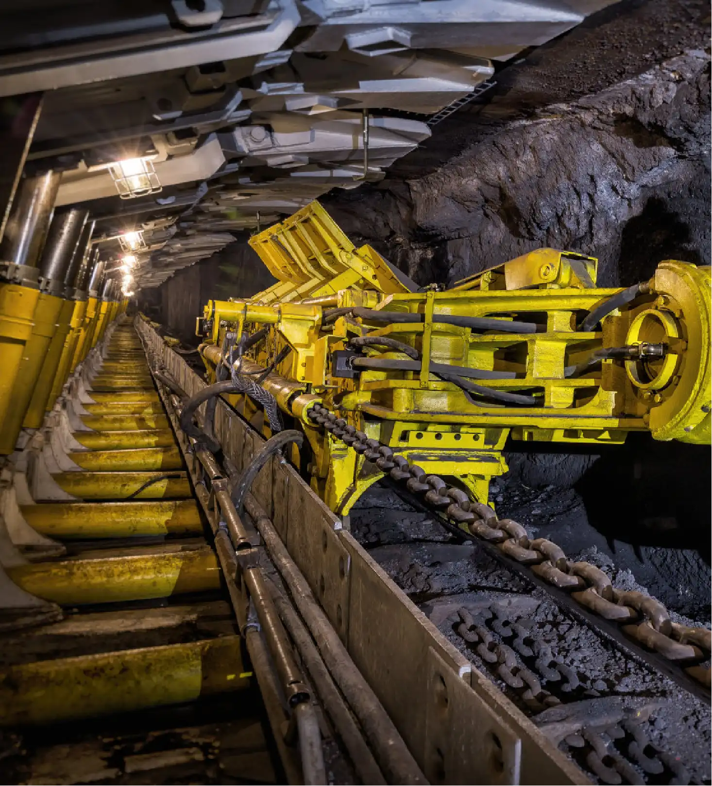
At present, the measurement of underground tunneling footage mainly relies on manual tape measurement and laser pointers. Laser pointers need to be moved forward frequently, resulting in spot drift, which increases the rework rate of cross-section remeasurement.
♦Poor Data Real-Time Performance
Data transmission depends on paper ledgers or handheld terminals. The shift footage can only be entered into the dispatching system after returning to the ground, failing to achieve real-time updates.
♦Low Data Reliability
Key indicators such as temporary support, blasting progress, and bolt row spacing lack a unified coordinate system. The cross-section is affected by dust, water dripping and vibration, leading to errors in tape reading. Over-breakage and floor heaving in rock roadways are common. Inconsistent statistical calibers among shift reports, daily reports and weekly reports cause gradual accumulation of deviations in mining and excavation connection plans.
Functional Requirements
♦Data Accuracy:Realize precise measurement and real-time positioning of the tunneling face via UWB high-precision ranging, reducing human errors.
♦Environmental Adaptability:Achieve stable centimeter-level distance output under dust, water mist and non-line-of-sight conditions through UWB high-precision ranging.
♦Data Anti-falsification:UWB ranging supports real-time data return, and real-time ranging is also performed between ranging anchors. Once the mobile ranging base station is moved, the distance change information can be viewed in the background.
Solution
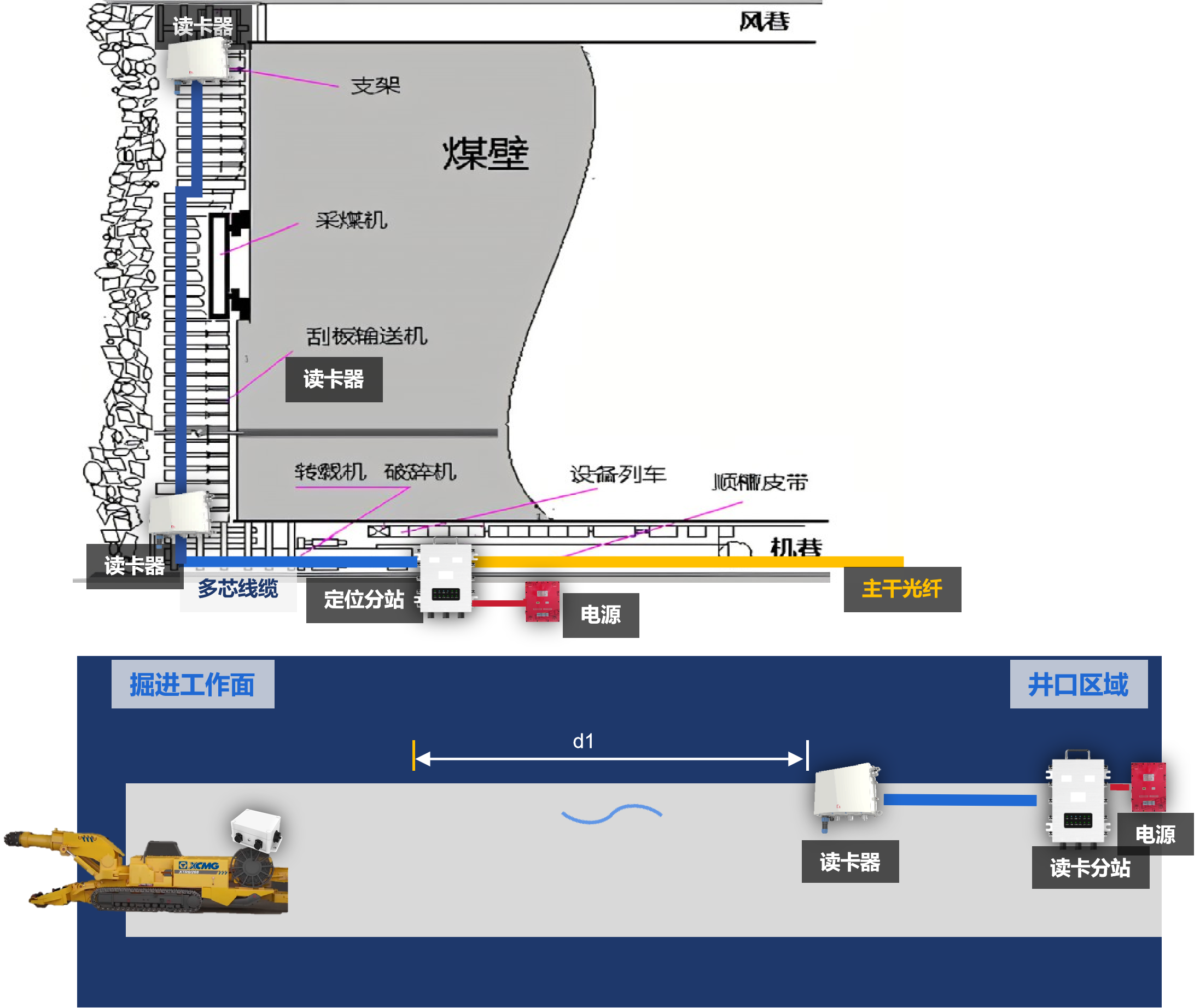
For footage monitoring of coal mining faces, it is necessary to collect position, displacement and time data of all major mobile equipment on the fully-mechanized mining working face to realize real-time monitoring of coal mining footage. For footage calculation of heading faces, the card reader at the roadway entrance is taken as the reference point. First, UWB ranging is adopted to obtain the precise coordinate distance d1 from the reference point to a certain section, which serves as a fixed reference point. Then UWB technology is used to conduct precise ranging of dynamic targets on this section to get d2, so the cumulative footage is calculated as d = d1 + d2. The daily heading footage equals the d2 value of the current day minus the d2 value of the previous day, while the daily mining footage equals the d2 value of the previous day minus the d2 value of the current day.
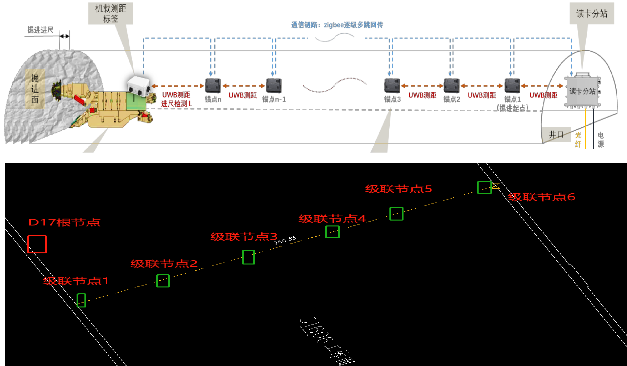
Multi-base Station Wireless Multi-hop Ranging Scheme
System Advantages
High real-time data performance:Measurement data is transmitted back to the communication station via Anchor n, Anchor n-1, Anchor n-2, …, Anchor 1, and then sent to the ground server in real time.
High data accuracy:Thanks to the strong environmental adaptability of UWB technology, high-precision ranging can be achieved in complex underground environments.
Data anti-falsification:Strict topological relationships are followed among all on-site positioning nodes. Raw data is transmitted upward level by level through nodes, preventing manual equipment movement or data tampering.
Quick deployment:Rapid ranging and networking can be realized between on-site positioning nodes, as well as between positioning nodes and the root node.
Low maintenance cost:Wireless base stations feature nearby power access, built-in antennas, and a lower risk of damage from roof fall compared with vehicle-mounted devices, resulting in a low overall maintenance cost.
Reuse of personnel positioning:Cascaded base stations can realize UWB signal coverage in roadways. In addition to tunneling footage measurement, they can also achieve accurate personnel positioning.
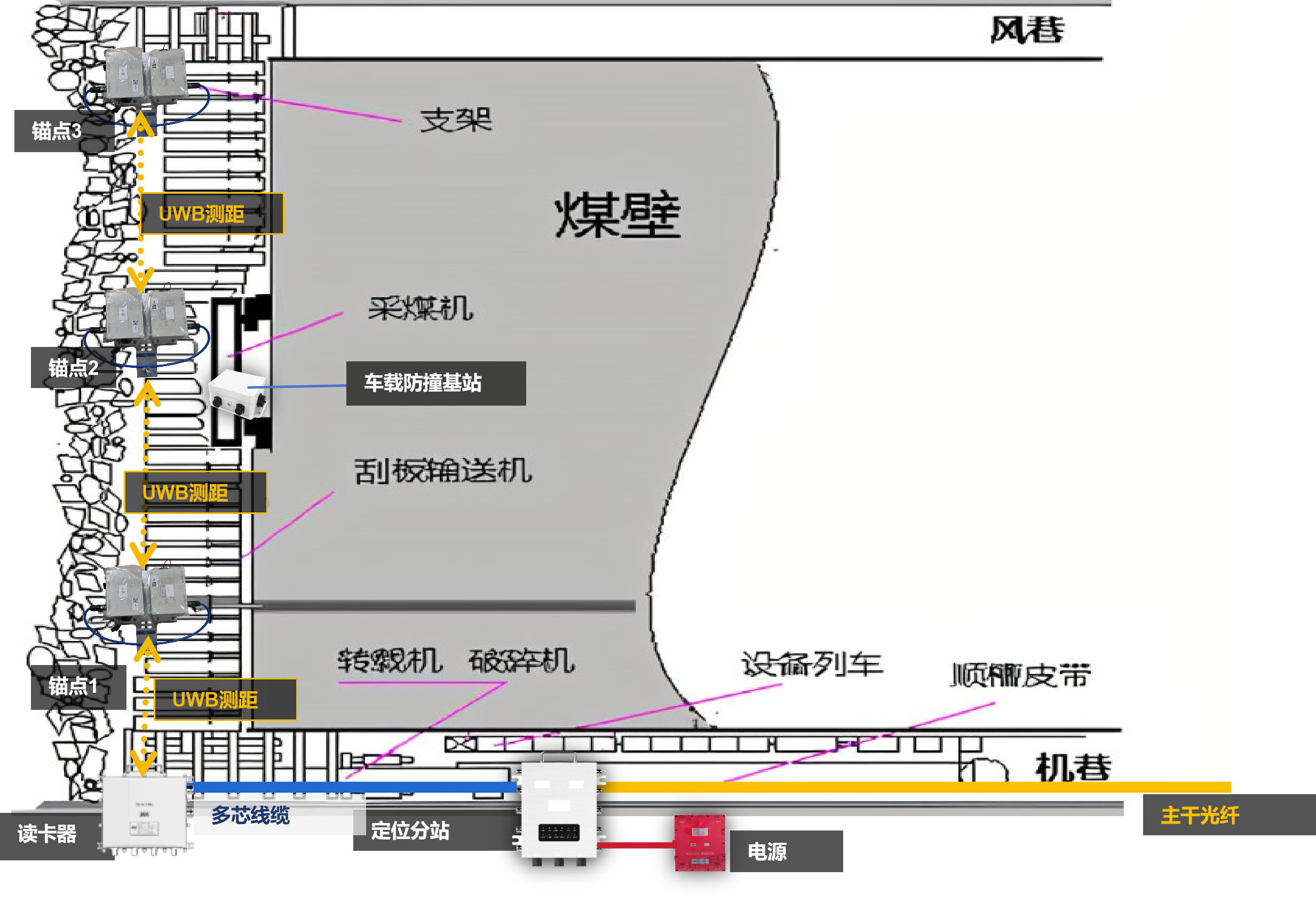
Personnel Positioning and Anti-Collision Management for Thin Coal Seams
Main Products
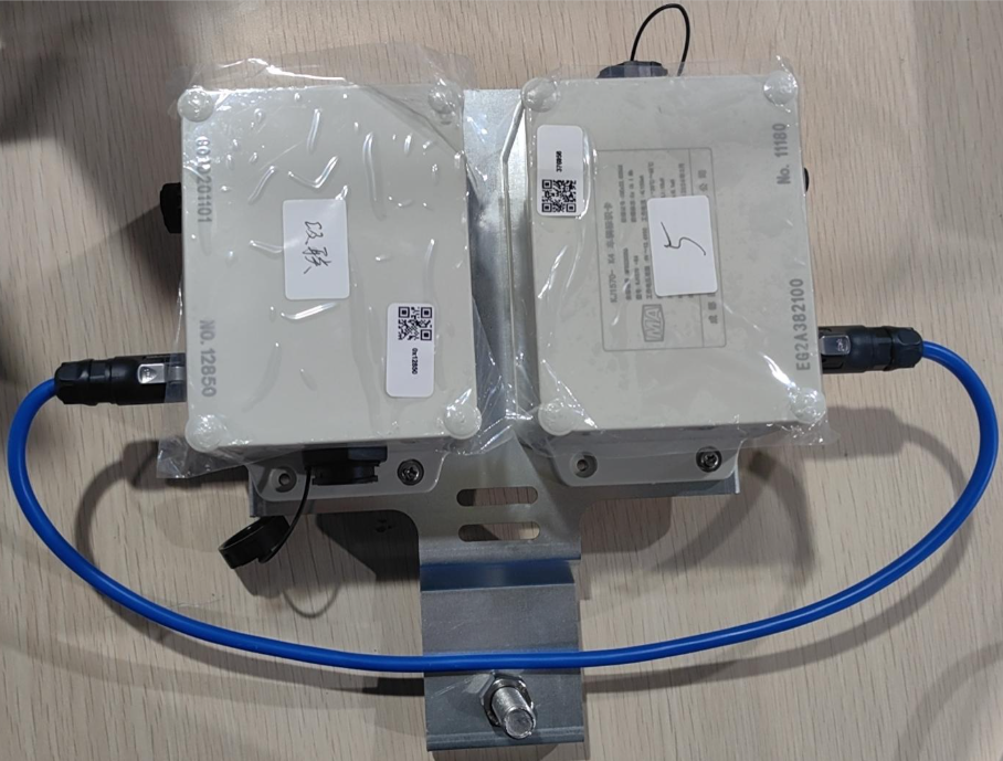
Product Weight: ≤1.3kg
External Power Supply: 4-pin aviation plug (red positive, blue negative)
Protection Grade: IP67
Positioning Wireless Standard: 802.15.4_2011 UWB
Positioning Method: TOF/TDOA
Communication Wireless Standard: 802.15.4_2.4GHz